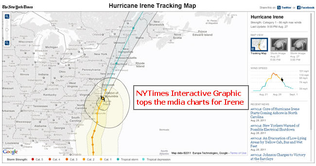
The NYTimes, just like in its coverage of the Japanese Earthquake and Tsunami, show that it is ahead of the print and Web media pack with its coverage of Hurricane Irene with its interactive storm track. This Google Map powered animation shows the relevant timeline and trail of Hurricane Irene, its precise direction, wind power, etc.
As with all Google Map apps one can zoom in and see the precise path and projections of it future movement. This is valuable for New Englanders and Maritime Canadians because they will have to bear the brunt of what appears to be the second major hurt from Irene – flooding and power outages.
Whats missing? No idea of the storm surges to be expected as Irene passes through. Also there is no overlapping of rainfall patterns as seen on the National TV coverage. So the NYTimes Interactive is ahead of the rest of the Web media like the Time, theDailybeast.com, WSJ, and even the Web based TV networks – but still has room for improvement. And given what hurricane forecasters are talking about for the rest of the season, the NYTimes may get an opportunity to move even further ahead of the pack.

